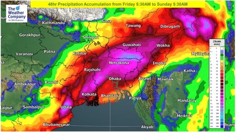
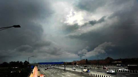
A low-pressure area, currently located over Odisha, is set to bring an intense bout of heavy to very heavy rains over the eastern and northeastern states of India on Friday.
According to The Weather Channel’s forecasters, Assam, Meghalaya and Sikkim will experience heavy to very heavy rainfall on Friday. Moreover, heavy rains are also forecast in Bihar, Jharkhand, West Bengal, Arunachal Pradesh, Nagaland, Manipur, Mizoram and Tripura.
A 24-hour precipitation accumulation (i.e. total rainfall volume) of over 100mm is also possible over eastern and northeastern India on Friday, and over northeast India on Saturday.

The India Meteorological Department (IMD) also forecasts that isolated places over Assam and Meghalaya will experience thunderstorms accompanied by lightning and gusty winds (with speed up to 30-40 kmph) over the next 48 hours.
The regional met centre also forecasts the possibility of thunderstorms with lightning across northeastern states on Friday and Saturday. Gale winds of up to 40 kmph are forecast in isolated places over Assam and Meghalaya. The IMD has issued an orange level alert for these two states, while other states in the northeast have been put under a yellow watch. IMD’s orange alert signifies ‘be prepared’ for extreme weather, while yellow watch recommends to ‘be updated’.
The circulation and the related low is expected to move northeastward on Friday, and reach northeastern India on Saturday morning. The intensity of rainfall is likely to drop after Sunday, as the low-pressure loses steam.
Since the start of October, five Northeastern states (Arunachal Pradesh, Assam, Meghalaya, Mizoram and Sikkim) have experienced ‘deficit’ rainfall as compared to the normal average, while Manipur has experienced a ‘large deficit’. However, with heavy rain headed their way, these statistics could change drastically over the weekend.

For weather & air quality updates on the go, download The Weather Channel App (on Android and iOS store). It’s free!


