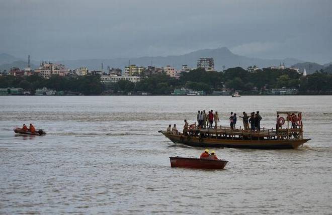
The Brahmaputra River has the second highest sediment yield per square kilometre in the world, exceeded only by that of the Yellow River in China. India’s central government and the state government of Assam have planned to dredge the Brahmaputra, with an initial amount of Rs 4 billion ($57 million).
One purpose of this dredging is to reduce flooding by allowing more water to stay in the river. The second is make the Brahmaputra navigable for large vessels – the river has been designated National Waterway 2 by the Inland Waterways Authority of India. It is planned as a vital component of trans-boundary inland waterways transport between India and Bangladesh.
Before the dredging starts, it is important to understand the nature of sediment transport in the Brahmaputra, because the dredged-out river is likely to be filled up again, partly or completely.
Sediment load of the Brahmaputra
The sediment deposited in the Brahmaputra varies across its length. At Tsela Dzong in Tibet it is about 150 tonnes per square km. But as the river crosses the Himalayas and reaches Pasighat at the foothills of Arunachal Pradesh in India, the deposit increases tenfold to 1,495 tonnes per square km. This shows that the river gathers sediments from soft rocks and landslide-affected areas of the Himalayas. The Higher Himalaya Range contributes about 70% of the sediments of the Brahmaputra, as explained by S. Krishnaswami and K. Singh in the September 10, 2005 issue of the journal Current Science.
The Brahmaputra then flows through Assam – forming the Assam valley, with the high Himalayas in the north and the Meghalaya plateau in the south – before entering Bangladesh. As measured at a station in Majuli – the largest river island in Assam – the suspended sediment load is slightly higher at 1,513 tons per square km, higher than at Pasighat, due to the contributions from the rivers Dibang and Lohit, which also flow down from the Himalayas on the north bank of the Brahmaputra.
Since the Brahmaputra is a trans-boundary river, data on its water discharge and sediment load are classified and thus the public has no access. Researchers can get the data after a lengthy process and only if they pledge not to share the data in public.
Sediment loads are measured as both suspended load and bed load. Suspended load is the sediment being carried by the water at the time of measurement, while bed load is the sediment that has settled down on the riverbed. Old data – published despite the ban – reveal that on an average the Brahmaputra transported 402 million tonnes of suspended sediment annually between 1955 and 1979 at the Pandu measuring station in Guwahati, the largest city of Assam.
According to Water and Power Consultancy Services, the average annual sediment yield between 1978 and 1991 was 527 million tonnes at Pancharatna near Goalpara, just a little upstream of the place where the river enters Bangladesh from India.
But this average means little. During the monsoon from May to October, the Brahmaputra transports 95% of the annual suspended load at Pandu at an average daily rate of 2.12 million metric tonnes. It would need over 141,300 trucks – of 15 tonnes each – to carry this away.
Although suspended sediment is measured at a few stations on the Brahmaputra, no convincing attempt has been made to measure its bed load. Dulal Goswami wrote in the 1989 (15.1) edition of the Indian Journal of Earth Sciences that he had estimated the bed load using several empirical equations and concluded that the bed load at Pandu was of the order of 5-15% of the total sediment load of the river.
Dredging feasible? Desirable?
Since suspended sediments form the majority of the load, will it be possible to maintain the dredged channel suitable for large vessels at the desired width and depth during the monsoon, when there is daily input of 2.12 million metric tonnes of sediments into the river?
And to what extent is this desirable? The authorities have stated that the main purpose of dredging the Brahmaputra is to prevent high flows from inundating its banks, which result in floods. But the valley of Assam has been created from the sediments deposited by floods of the Brahmaputra and its tributaries. During last two million years it has deposited 200-1,000 metre thick sediments by flooding and lateral channel migration.
Natural floods have several benefits besides increasing soil fertility. But artificial heavy floods have been created in Assam either due to breaching of embankments or sudden release of impounded water to keep dams safe. Such floods deposit enormous quantities of sterile sands rather than fertile sediments. For flood control, the solution should lie with improving or disbanding embankments and dams rather than with dredging.
Dredging seems to be a superficial answer to the challenge of drainage congestion and managing floods. Proper planning and a detailed study of the basic aspects of this government project are needed. A critical analysis of the data on both sediment input and dredging depth, together with a far better idea of the bed load, is necessary before starting this mega project.
Jogendra Nath Sarma is a retired professor of applied geology at Dibrugarh University, Assam, and the author of two books on the Brahmaputra.
This article was originally published on The Third Pole.

