by Eric Jeansonne |
BILOXI, Miss. (WLOX) – While it is typical for tropical waves to roll off the African coast this time of year, it is also common to for large plumes of dust to come off the coast as well.
According to NOAA, these large plumes of dust are part of a dry, dusty air mass that forms over the Sahara Desert from extreme heat and dust storms. This air mass is called the Saharan Air Layer (SAL) and can extend 5,000 and 20,000 feet in the air.
Large plume of Saharan dust to make for hazy skies, vibrant sunsets this week
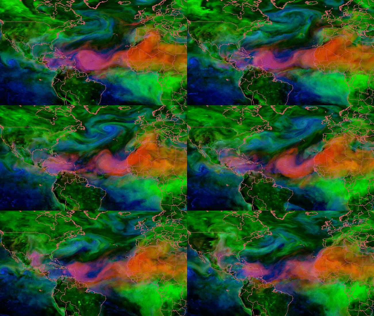
NASA Satellites have been tracking several plumes moving across the Atlantic over the last couple of weeks and one plume is forecast to move over the Gulf of Mexico and into South Mississippi over the weekend into early next week (June 22-25).
NOAA Satellite image on June 22, 2019 captures a large plume of dust from the Sahara Desert tracking into the Gulf of Mexico and the southeastern US.
NOAA Satellite image on June 22, 2019 captures a large plume of dust from the Sahara Desert tracking into the Gulf of Mexico and the southeastern US.
NOAA Satellite image on June 21, 2019 captures a large plume of dust from the Sahara Desert tracking across the Caribbean.
NOAA Satellite image on June 21, 2019 captures a large plume of dust from the Sahara Desert tracking across the Caribbean.
NOAA Satellite image on June 20, 2019 captures a large plume of dust from the Sahara Desert tracking into the Caribbean.
NOAA Satellite image on June 20, 2019 captures a large plume of dust from the Sahara Desert tracking into the Caribbean.
How does it get all the way to South Mississippi?
When dust is lofted that high into the atmosphere, it can get carried by winds around high pressure and sometimes make it as far west as the Gulf Coast, including South Mississippi. Each year, NOAA says, over one hundred million tons of dust is carried from Africa across the Atlantic.
So will the skies darken?
Not quite. When dust makes it to the Gulf Coast, it typically results in hazy, milky white skies during the day if clouds are not present. Sunsets can appear more vivid and redder when the view is not blocked by clouds.
Will it make it hard to breath?
The SAL can have an impact on air quality. However, by the time it gets to the Gulf Coast and South Mississippi, the dust is usually not in as high of a concentration to cause extreme issues. However, for people who are unusually sensitive to air pollutants, it can make breathing difficult. This includes those with lung and heart disease and COPD.
Can it impact hurricanes?
NOAA research over the last few years has found that the SAL can temporarily suppress hurricane and tropical storm activity. That is because the SAL is very dry and prevents thunderstorms from developing. The dust also aids in the sinking motion of air and reduces the ability for thunderstorm updrafts from forming.


